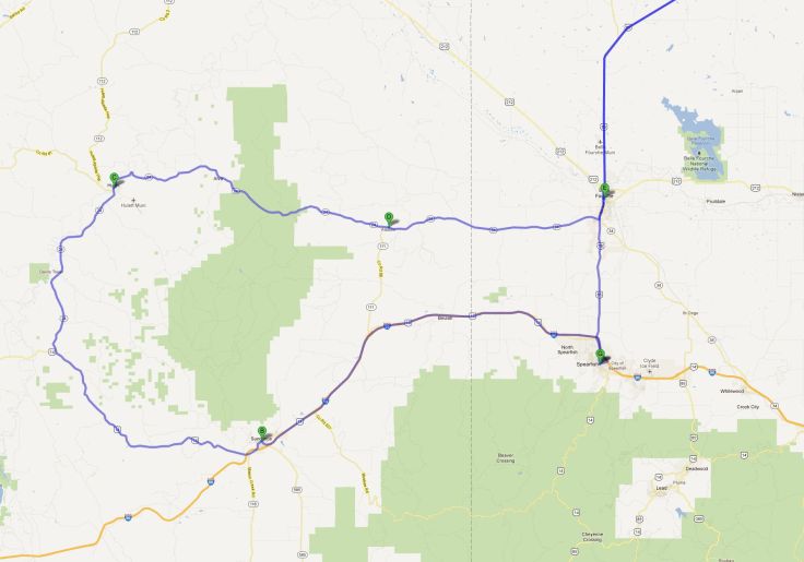
We headed out of Sundance (WY), heading West on US-14. Our destination, Devil’s Tower, is a US National Monument. Clouds began to occupy the sky even as we made our way there, and caused me to wonder what they were protesting. Whatever it was, they provoked my annoyance; didn’t they have better things to do than block my Sun? For instance, I knew the whole area where I live was under High Fire Danger warnings precisely because no rain clouds, or clouds of any kind, had bothered to show up for work.
Edited to Add: Apparently WordPress saw it fit to remove all my links from the photos, as well as remove the captions. I can repair the caption, but not going to try the links again. If you want to see the full size versions of them, the SmugMug Gallery is HERE. It that does not work (thanks WordPress), this is the URL:
http://ejdalise.smugmug.com/Travel/The-Devils-Tower
And yet, here they were, aiming to mess up my photo efforts. Oh well.

The Tower itself had quite the history. As many people know, around 5,000 years ago or so, while giants still roamed the earth, massive trees ruled over the landscape. Devil’s Tower is one of few remaining stumps, and it’s only with us because its wood was petrified. It’s estimated the stump was buried for more than 1,000 years, during which time the organic material was completely replaced by minerals in a process called permineralization.
Eventually, probably softened by the waters of the Great Flood, the surrounding terrain eroded, only to leave the stump, measuring about a mile in diameter at the base, and reaching 867 feet into the sky.

Using equations empirically derived from data for existing trees, including Sequoias, we can estimate the size of the tree based on its one mile base perimeter. Of course, we cannot be sure because we don’t know exactly what kind of tree it was, but conservative calculations would put its height at close to 2,000 feet.

American Indians, of course, have their own versions of the origins of the Tower. One of the versions is the Brule Sioux Legend. I’m going to shorten it for this post, but you can read the full version HERE.
These two kids get lost, you see, and as they wander the woods they become aware of the giant grizzly bear, Mato, staking them. Panicking, they run, with the great bear giving chase. They stumbled, and just as the bear was to pounce upon them, the earth shook, and the very ground itself rose a thousand feet, carrying them to safety. Angry, the bear tried to scale the sides to get at them, and hence the markings on the side of Devil’s Tower; claw marks.
Eventually the bear left, and the boys were likely brought down from the top of the tower by Wanblee, the eagle that had befriended The People.
Crazy Indians! As I said, we know it was a giant tree, probably felled by one of the 36-foot tall giants, swinging an ax taller than six men (or four modern men – regular people were shorter back then), referenced in Genesis . . . I never cease to be surprised at the crazy stories people make up.
. . . Mato, the giant bear . . . sheesh!
Anyway, as one can see, the sun was shielded by Occupy-The-Sky clouds, but the plus of that was that many of the colors of the petrified giant came through without being washed away by bright sunlight.
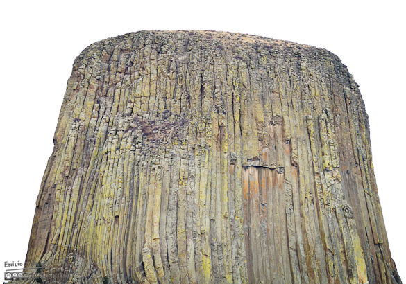
Still, for a while I was shooting with the idea of doing a black and white album of my visit to the Monument.

But then the Sun had enough of them pesky clouds, and started to burn them away.

By the way, I am trying a new suggested size and color space for the pictures I insert in the post. Supposedly it will provide better results (as in showing the pictures closer to what they should look like). I am not impressed, but don’t care to go back and rework all the photos. Anyone interested in seeing the photos in all their glory should go to the SmugMug gallery. Not only are there more photos, but they look much better.

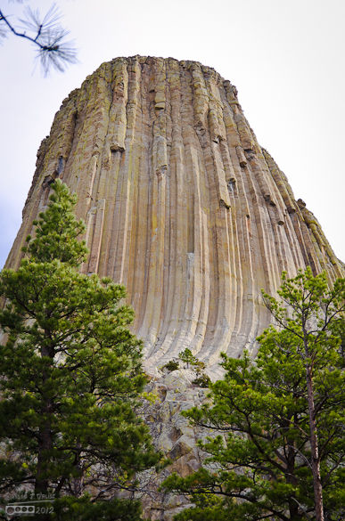
The perimeter of the Tower is about one mile. There is a 1.3 mile paved path around the base, and pretty much I snapped photos of the tower from every angle imaginable while walking it.

OK, OK . . . I’ll quit bitching.
Anyway, for as long as there have been people (6,000 years or so, according to some), there has been someone like me . . . most of them were likely burned alive, but others were successful in following through on their urge to climb this Tower. There were no climbers making the attempt while we were there, but there are remnants from less modern times indicating people made their way up there. You can see the Pole Ladders that had been used to scale the petrified tree. I don’t know why only Poles scaled the tower. I would have thought at least a few Italians would have tried.

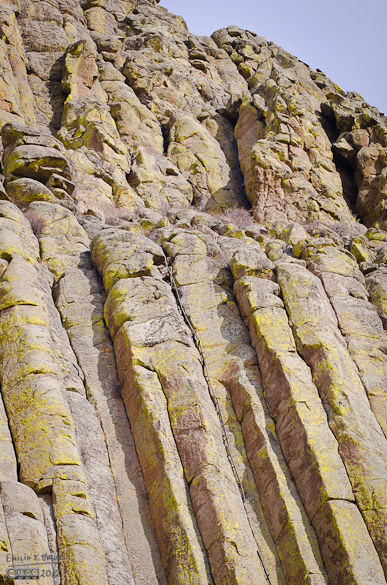
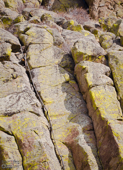
Honest, as an engineer I would be very reluctant to avail myself of those particular climbing aids.
Lest anyone thinks the sole attraction is the Tower, impressive as it is, the surrounding countryside is also a thing to note.

And the forest surrounding us offered up many sights.


We even saw a miniature tower, stunted and forever relegated to wannabe status.
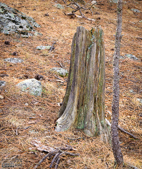
And of course, the obligatory ant shot . . .

Here is another shot of the forest floor drawing my camera toward it.
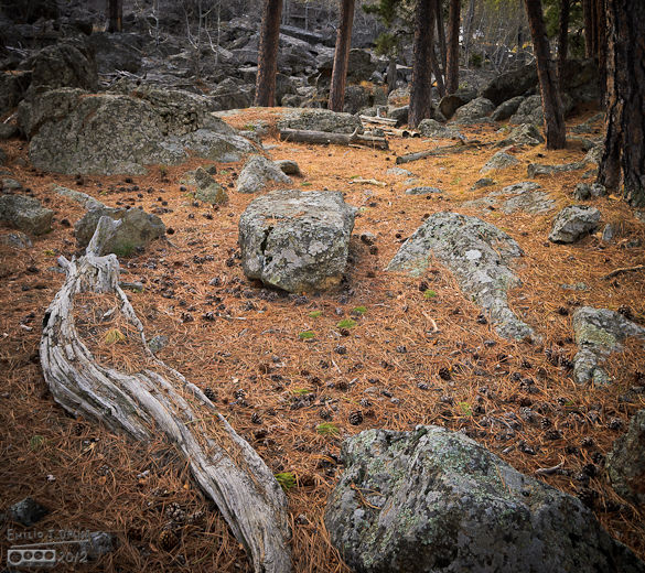
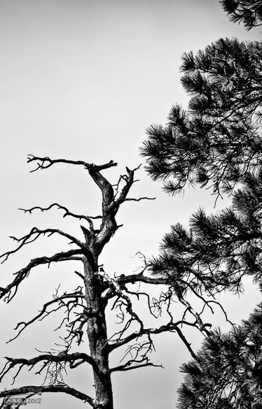
Here are a few more interesting shots . . .


Eventually we made it all the way around. These two guys were heading up in between the boulders. They did not look like climbers, and likely just wanted to do what I wanted to do . . . act like mountain goats. What they did do, is offer me an opportunity to lend some scale to the scenery.


This next shot was the last shot from the visitor center . . .

On the way out we stopped at a little picnic place to grab a bite to eat and mentally prepare for our raid into North Dakota. There I snapped a few pictures of a sculpture commemorating Indian beliefs.


After eating some, we kept going along the loop back to Belle Fourche, and north toward North Dakota.
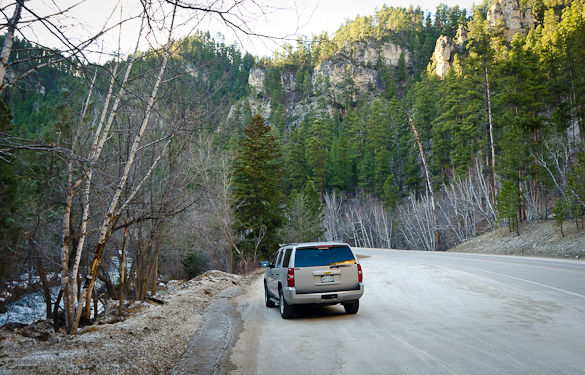
When the road did not look like this:

. . . it had pickups heading south, all toting empty trailers. We theorized these were people who made supply runs to Costco in support of the people catering to the oil boom going on in North Dakota. Unfortunately I had misread the map . . . what I thought to be a two hours round-trip was more along the lines of three and a half hours round-trip, but we eventually reached our goal.


Belle Fourche is designated as the geographic center of the United States (because of the inclusion of Alaska and Hawaii). We did not know that until the day after, or would have stopped to snap a picture of the sign.
Our goal for the night was Lusk, Wyoming, specifically the Best Western there. This time we drove straight South on US-14 Scenic Highway. Once again we were in a race with darkness, and once again we lost, arriving in Lusk well after dark.
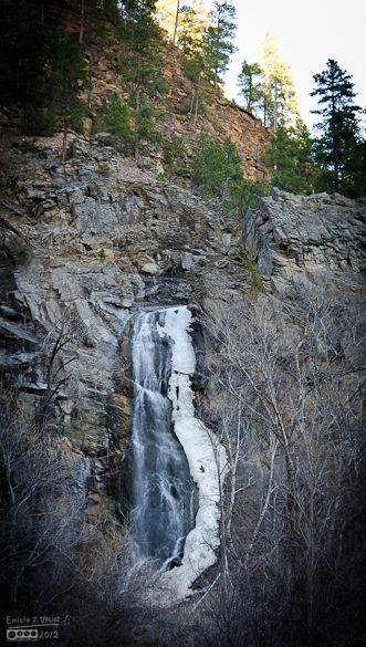
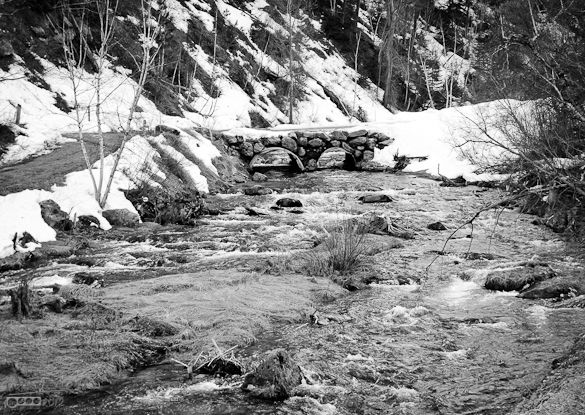
But there was a reason. It’s a scenic highway, you see . . .



The next day saw us in a four and a half hour drive back through Cheyenne, through a congested Denver, and home. I did not snap any pictures, as nothing of note jumped out at me.
Plus, there were some hellacious cross-winds, and in many places they were kicking up quite the dust storms. It felt like it was prudent to head home.
Home, to a water heater that would burst not 30 minutes after we got home. But, that’s another story.
As always, thanks for stopping by, and thanks for reading my stuff.
<><><><><><><><><><o><><><><><><><><><o><><><><><><><><><>
About awards: Blogger Awards About “likes”: Of “Likes”, Subscriptions, and Stuff
Note: to those who may click on “like”, or rate the post; if you do not personally hear from me, know that I am sincerely appreciative, and I thank you for noticing what I do.
. . . my FP ward . . . chieken shit.
There’s a picture of my Mom holding be as a baby in front of the Devil’s Tower. So, technically I’ve been there. But I usually say I haven’t because I have no memory of it. Anyway, it looks like a cool place. I love the shots you took of it, especially the detail shots and the black and white one. I also love those photos of the road in front of the car. There’s so majestic about a plain ribbon of roadway stretching out in front of you.
LikeLike
I didn’t know a tree stump like that existed, it’s mind blowing. Thanks for the pics.
LikeLike
This is one of my most fond places from the Round the US in a year trip my folks took me on in the early 80’s. You did a good job of trying to capture the enormity of the thing. When I was there there were climbers and having the correct perspective kind of blew my mind. We only stayed at the tower overnight if I remember corrcetly. I never got to take any of the long trails, only some small stuff at the base.
LikeLike
I also had no idea of the history of Devil’s Tower — and that it’s actually a tree and not a rock. Knowing that, now I MUST go there myself!! I’m a hopeless tree-lover.
I spent a good deal of time flipping through the entire SmugMug album. Those are some beautiful photos. The Air Show Museum now pales to this one as my favorite album. The “ant shot” (I love to lay on the ground and look up at tree tops), the “trails” of the surrounding wooded area, and the black-and-white artistics are my favorites. You spent a lot of time putting all of that together. Thank you!
LikeLike
emilio, did you feel like lewis and clark?
LikeLike
Thank you thank you thank you!!! First, once again your photos are amazing, you have brought back memories that I had forgotten, literally, for decades. You photo journey was a journey back in time.
LikeLike
Wow . . . I did not realize so many people had a connection to this monument. We had passed by it twice before, but both times opted to continue to our destination without visiting it. Now I’m glad we did.
The dedicated visit allowed for more exploration than I would have otherwise done. It is an impressive structure, to be sure, and I’m glad my own journey rekindled other people’s memories of the place.
LikeLike
I can only imagine how incredible this place must be in person. I’m dying to go there sometime soon. It’s surprising how colorful the rock really is (I know some of your shots are enhanced, but still). Incredible landscape, too — what a mix of rock and Ponderosa pine and agricultural land.
It’s funny, I always think the pictures on WordPress look fine and that maybe the photographer doth protest too much, but then I click on the SmugMug links and they just really — and here is the technical term — pop.
Also, all of North Dakota takes umbrage at your brief dalliance with their state.
LikeLike
I wanted to stop at Devil’s Tower on a drive from Minnesota to Idaho but didn’t have time. Do you have a link to your smug mug gallery? I couldn’t find it. Thanks.
LikeLike
If you click on any of the pictures (other than the map) it will take you there. Clicking on the first photo (not the map) will take you to the beginning of the gallery. Subsequent ones all go to the respective pictures, but once in SmugMug you can navigate independently of the post.
Here is the link: http://ejdalise.smugmug.com/Travel/The-Devils-Tower/22163165_9kFbvX#!i=1769716886&k=Z5kZjLT
LikeLike
I’ve been reading that Devil’s Tower is a natural rock formation that looks like a petrified tree trunk, so . . . which is it?
That said (or asked) I took a tour of the SmugMug album and was impressed by how you captured its grandeur and the surrounding flora. Love the shots with the pine-needle covered ground. There are too many great shots for me to list them all but one really stands out and that is the one of the “photogenic” stream/river right under the waterfall photo. Excellent! Your commentary, as usual, was entertaining and informative. Overall, a great album and post!
LikeLike
Well Ann . . . on April first it’s a tree trunk. The rest of the time it’s a volcanic cone that never made it to the surface, cooled, and then the surrounding ground did erode a way and leave it for us as inspiration for made-up stories.
LikeLike
Darn it, forgot about April Fools Day. You had me for a while until my reasoning kicked in and I decided to do some research. Didn’t think to check the date . . . nevertheless, it’s a good piece.
LikeLike
It’s still a good place to revisit, if only photographically, years later . . . it must give off a majestic presence in person, though . . .
LikeLike
It’s so different that one doesn’t quite know what to make of it. It literally looks out of place.
LikeLike